search-icon
Latitudes

During this mission in the Austral and Cook Islands, we have covered more miles than any other Global Reef Expedition mission. During this month we will have surveyed 8 different islands in two countries and the Golden Shadow will cover 1650 nautical miles (1900 miles, 3056 km).
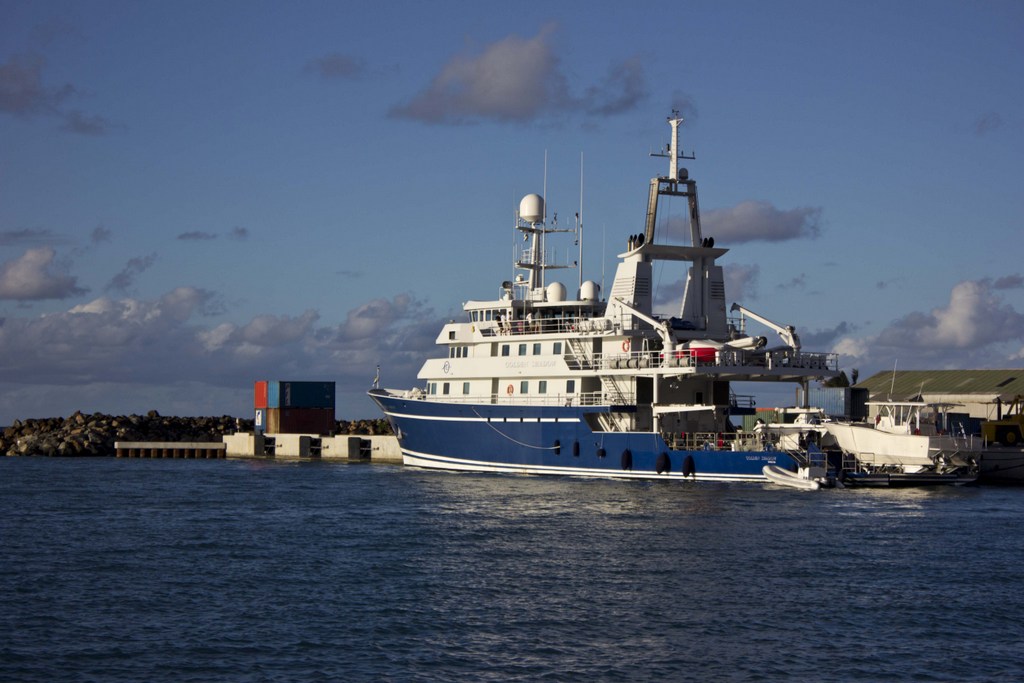
The Golden Shadow at the harbor in Rarotonga

During this mission we will have started just outside of the tropics in Raivavae and moved slowly north the entire mission. Many will know that it gets colder the further away from the equator you get, and water temperatures are the same. So as we move from one place to the next the divers are happy to be further north and in warmer waters. The coldest we have recorded was 25.05 degrees (77.09 F) and the warmest so far has been 28.63 (83.53 F). That may not seem like a huge change in water temperatures, but it makes a big difference to the divers, and it also makes a big difference to the coral reefs! While there are cold water corals, the majority of hard corals like warm water temperatures and that is why you find them in the tropics.
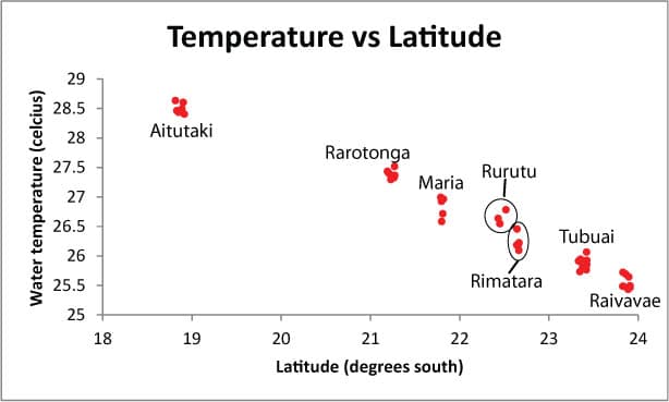
This graph shows that the water temperatures around each island have gotten warmer the further we move north


(Photo 1 Erwan Delrieu-Trottin)

To follow along and see more photos, please visit us on Facebook!
Related Posts

2025-2026 B.A.M. Student Voices

Throughout the Bahamas Awareness of Mangroves (B.A.M.) and Jamaica Awareness of Mangroves in Nature (J.A.M.I.N.) programs, we evaluate each phase of the mangrove education and restoration process to better understand how students are learning, growing, and connecting with their coastal environments.

Before the programs begin, students share what they already know about mangroves and how they feel about them. As the program progresses, we continue to gather feedback to see how their knowledge evolves from identifying mangrove species and understanding food webs to recognizing the role mangroves play in coastal protection and climate change mitigation.

But the surveys go beyond science content.

We also ask students…

Read More

Ten Years of B.A.M.: Rooted in Partnership, Growing in Purpose

Ten years ago, the Bahamas Awareness of Mangroves (B.A.M.) program began with a simple but meaningful commitment: to connect Bahamian students with the mangrove ecosystems that shape and protect their island home.

Since 2015, B.A.M. has been implemented in partnership with Friends of the Environment, whose dedication to environmental stewardship in Abaco has made this program possible year after year. Together, we have worked alongside Patrick J. Bethel High School and Forest Heights Academy to bring hands-on mangrove science into classrooms and out into the field.

What makes ten years remarkable is not just longevity — it is consistency…

Read More