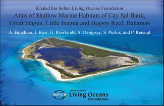
The Bahamas Atlas, Atlas of Shallow Marine Habitats of Cay Sal Bank, Great Inagua, Little Inagua and Hogsty Reef, Bahamas, is the result of months of underwater research to survey and map the seafloor. The Atlas combines advanced satellite imagery, aerial photography, and data from hundreds of research dives into the first-ever high-resolution coral reef ecosystem maps of many of Bahamas reefs.
In 2011, scientists and divers from the Khaled bin Sultan Living Oceans Foundation, Bahamas National Trust, the Department of Marine Resources, The Nature Conservancy, the National Coral Reef Institute, and the Atlantic and Gulf Rapid Reef Assessment Program joined forces to complete comprehensive scientific surveys of Bahamian reefs including Cay Sal Bank, the Inaguas, and Hogsty Reef. This is first of the underwater Atlases published from the world’s largest coral reef study, the Global Reef Expedition, which was launched in The Bahamas in 2011.
INTRODUCTION
The Bahamas extend approximately 1600 km from the Little Bahamas Bank in the northwest to Navidad Bank in the southeast, covering an area of approximately 122,000 km² (Trumbull 1988, Banks 1999, Sullivan Sealey and Bustamante 1999). The islands are aligned northwest to southeast, extending over 6 degrees of latitude and 9 degrees of longitude. The islands cover more than 1400 km linear distance from just south of Florida to southeast Cuba. The Bahamas represents the largest shallow water bank system in the insular Caribbean/Western Atlantic. There are 13 major islands, approximately 700 smaller islands and cays and some 2500 islets, with a total land area of about 13,880 km.
Most of the land in the northwestern portion of Bahamas is found atop three shallow (<10 m) carbonate platforms or banks, Little Bahama Bank, Great Bahama Bank, and Cay Sal Bank. The islands are low-lying, less than 10 m elevation, with a maximum elevation of 61 meters.
The southeastern Bahamas consists of smaller platforms, made up of a series of smaller islands and shallow water reefs extending from Crooked Island to Navidad Bank. These islands are separated from one another by deep water basins and troughs of up to 4000 m. To the south is the western extension of the Puerto Rico Trench, Cuba and Hispaniola. To the north and east, slopes plunge to oceanic depths. The southeastern islands have a slightly higher elevation than the islands in the northern Bahamas.
All of the islands of the Bahamas are composed primarily of Late Quaternary shallow-water and eolian carbonates (e.g. limestone), less than 500,000 years old, that sit on top of oceanic and/or continental crust. In some locations carbonate sediments are up to 5.4 km thick. The modern sediments on the banks are mostly non-skeletal ooids, peloids, and carbonate muds (Purdy, 1963b; Traverse and Ginsburg, 1966) and do not contain any significant siliclastic component.
The carbonates were formed by both physical and biogenic processes and deposited in a spectrum of environments ranging from lakes and dunes to deep-sea basins. Most of the limestones that make up the islands of the Bahamas were deposited during sea level highstands (corresponding with climatically warm interglacials periods) that occurred in the Pleistocene and Holocene. During such highstands, the banks were partly flooded by seawater. Through deposition by algae, benthic foraminifera, coral and molluscs, and the inorganic precipitation of calcium carbonate, large amounts of sediments were produced. Some of this was deposited on the platform surface, and some was transported off the platform allowing the islands of the Bahamas to build laterally. During times of lowstands (cold glacial intervals), weathering and pedogenesis result in the development of soils. With burial and diagenesis, these soils became paleosols (calcretes buried beneath other sediments and lithified into rock)…