Building the most accurate, most comprehensive, coral reef maps

Maxar August 13, 2019 By Sam Purkis, PhD, Chief Scientist of the Khaled bin Sultan Living Oceans Foundation   How the Khaled bin Sultan Living Oceans Foundation used Maxar satellite imagery to create the largest high-resolution maps of coral reefs …

Big data and the race to save coral reefs

JMP June 28, 2019   With climate change fast eliciting coral bleaching on global scales, marine biologists are using predictive modeling to help prioritize conservation efforts.   Though coral reefs constitute less than 2% of the Earth’s oceans, they play …

Science Magazine | Atlas shows remote coral reefs

Science Magazine May 3, 2019 Scientists have produced a global atlas of coral reefs with unprecedented breadth and detail, providing a new baseline to track the health of these living structures threatened by climate change. The atlas (https://maps.lof.org/lof) focuses on …

Scientists Create Giant Atlas of World’s Most Remote Reefs

Gizmodo Australia April 24, 2019 Coral reefs line shores around the world, but they’re sometimes tough to spot because well, they’re underwater. Now, a group of researchers has found that satellite imagery is capable of mapping reefs on a global …

New Atlas Captures Conditions of Nearly One-Fourth of World’s Coral

Popular Mechanics April 25, 2019 An international team of scientists has created the world’s first global coral reef atlas. The atlas, created with the help of Earth-orbiting satellites and field observations, contains 25,097 square miles (65,000 square kilometers) of coral …

High-resolution habitat and bathymetry maps for 65,000 sq. km of Earth’s remotest coral reefs

A study from scientists at the Khaled bin Sultan Living Oceans Foundation and the University of Miami offers a new way to accurately map coral reefs using a combination of Earth-orbiting satellites and field observations. Using this new method, the scientists mapped over 65,000 km2 of coral reefs and surrounding habitats–by far the largest collection of high-resolution coral reef maps ever made.

Scientists Create Largest Collection of Coral Reef Maps Ever Made

A study from scientists at the Khaled bin Sultan Living Oceans Foundation and the University of Miami offers a new way to accurately map coral reefs using a combination of Earth-orbiting satellites and field observations. Using this new method, the scientists mapped over 65,000 km2 of coral reefs and surrounding habitats–by far the largest collection of high-resolution coral reef maps ever made.

The world’s living oceans

KAUST.edu November 19, 2018 
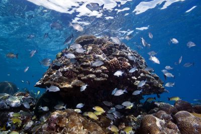
The Khaled bin Sultan Living Oceans Foundation has been a major player in the preservation of marine life and the environment since it was established in December 2000. From its beginnings, the foundation adopted a specific strategy focusing …