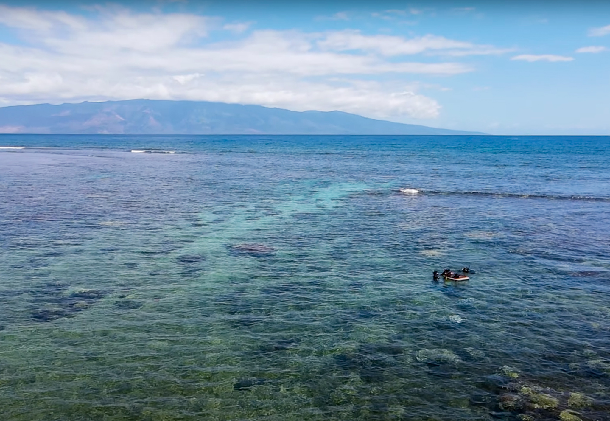
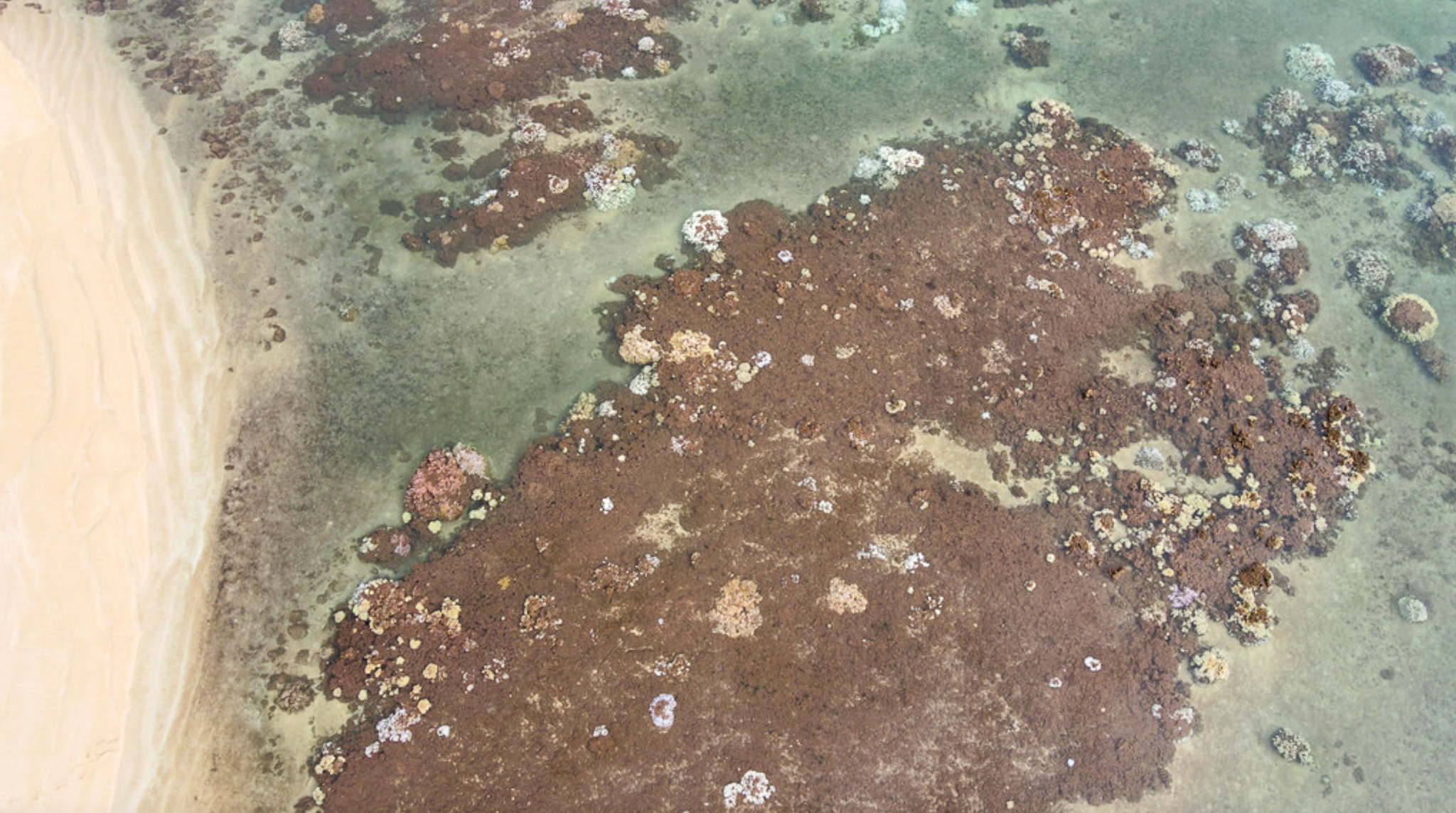
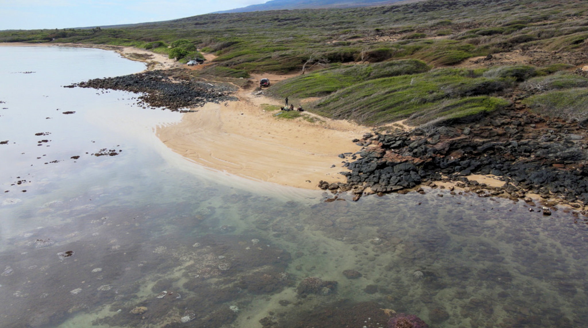
As the sun begins to rise over the island ridges of Lana’i, Hawai’i, the drone lifts off from its landing pad on the beach and begins to fly a grid along the coast, imaging the nearshore coral reefs. The drone is being flown by Dr. Ved Chirayath from the University of Miami Rosenstiel School of Marine, Atmospheric, and Earth Science’s Aircraft Center for Earth Studies (ACES). Ved has pioneered a new approach to mapping reefs using drones equipped with fluid lensing technology. While this cutting-edge technology is capturing reefs by air, the need for in-water validation of those images and census of marine life is critical to understanding the status of this coral reef ecosystem. And that is where my expertise comes into play.
I have been surveying reefs all over the world for the past 10 years, and I am excited to be putting my skill set to use again in the field. Traditional underwater surveys of both the benthic and fish communities, combined with drone surveys, gives the most detailed information regarding the health of the coral reef ecosystem.
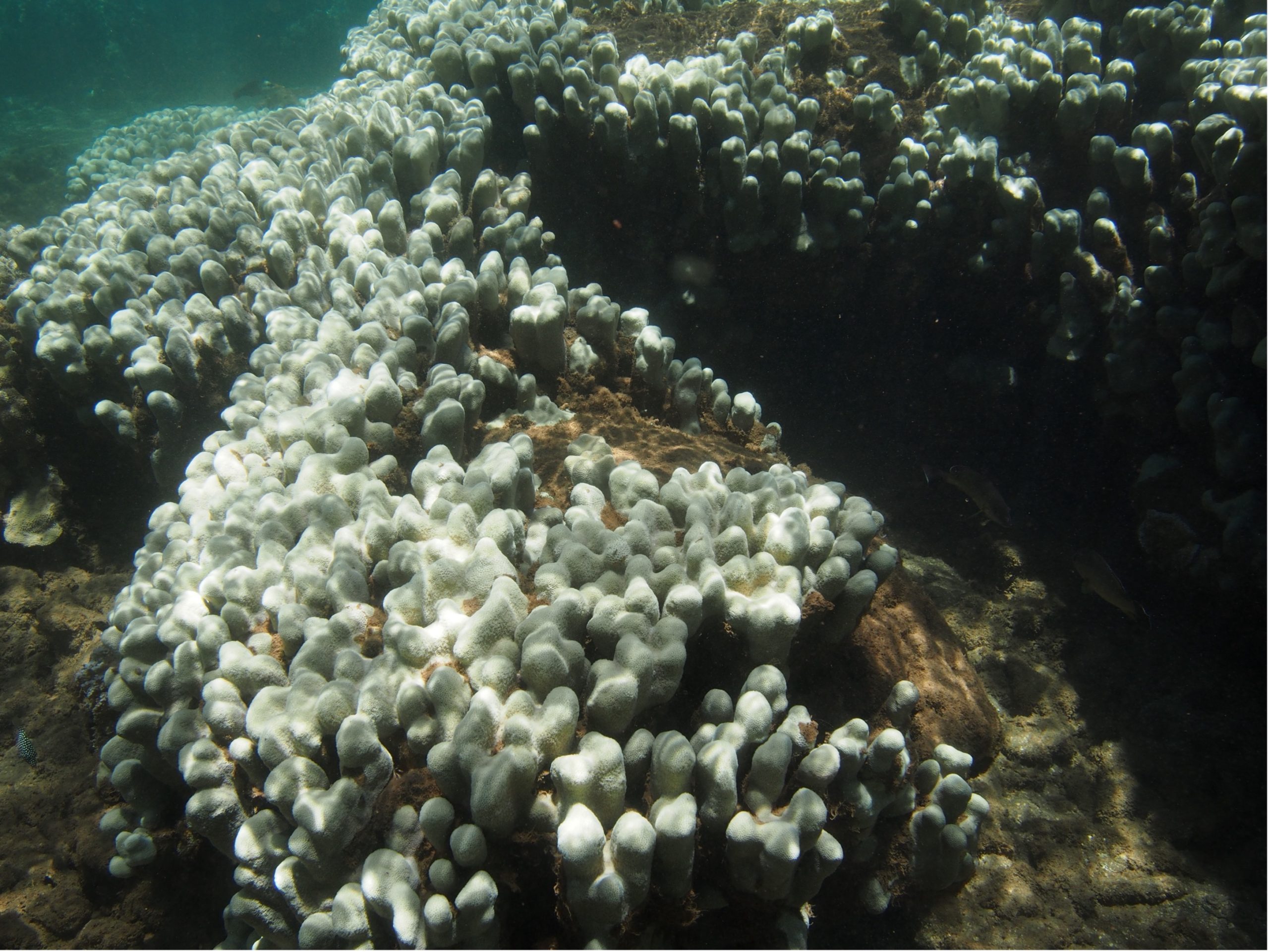
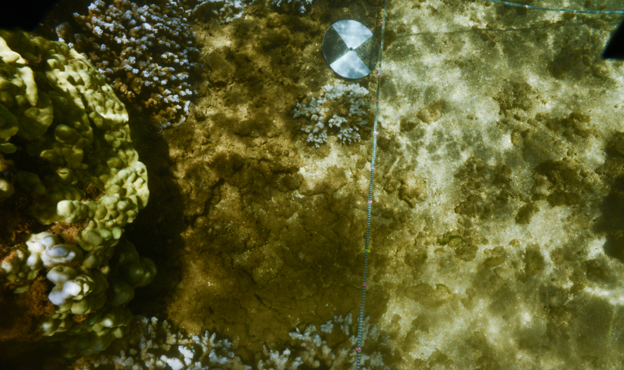
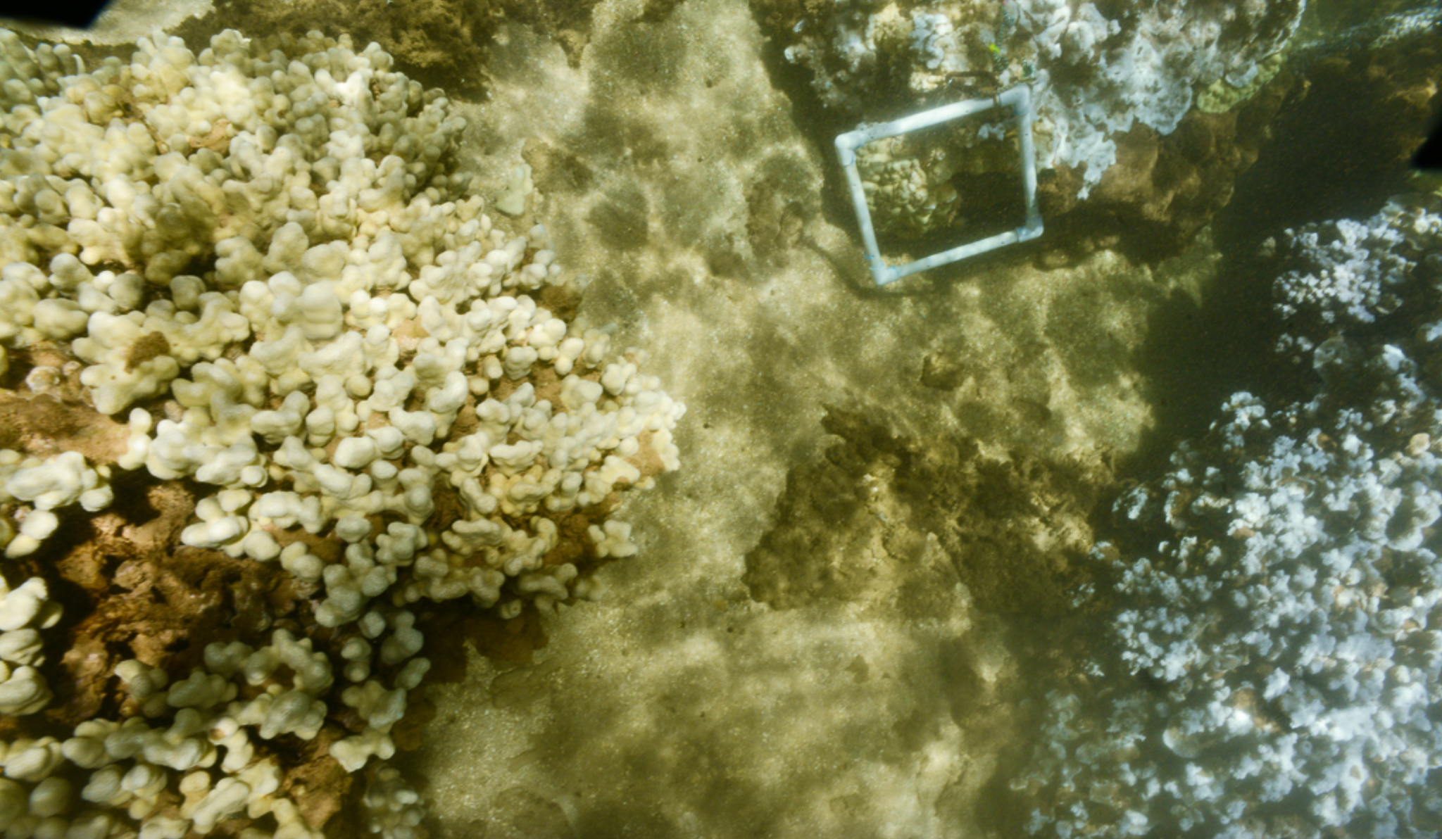
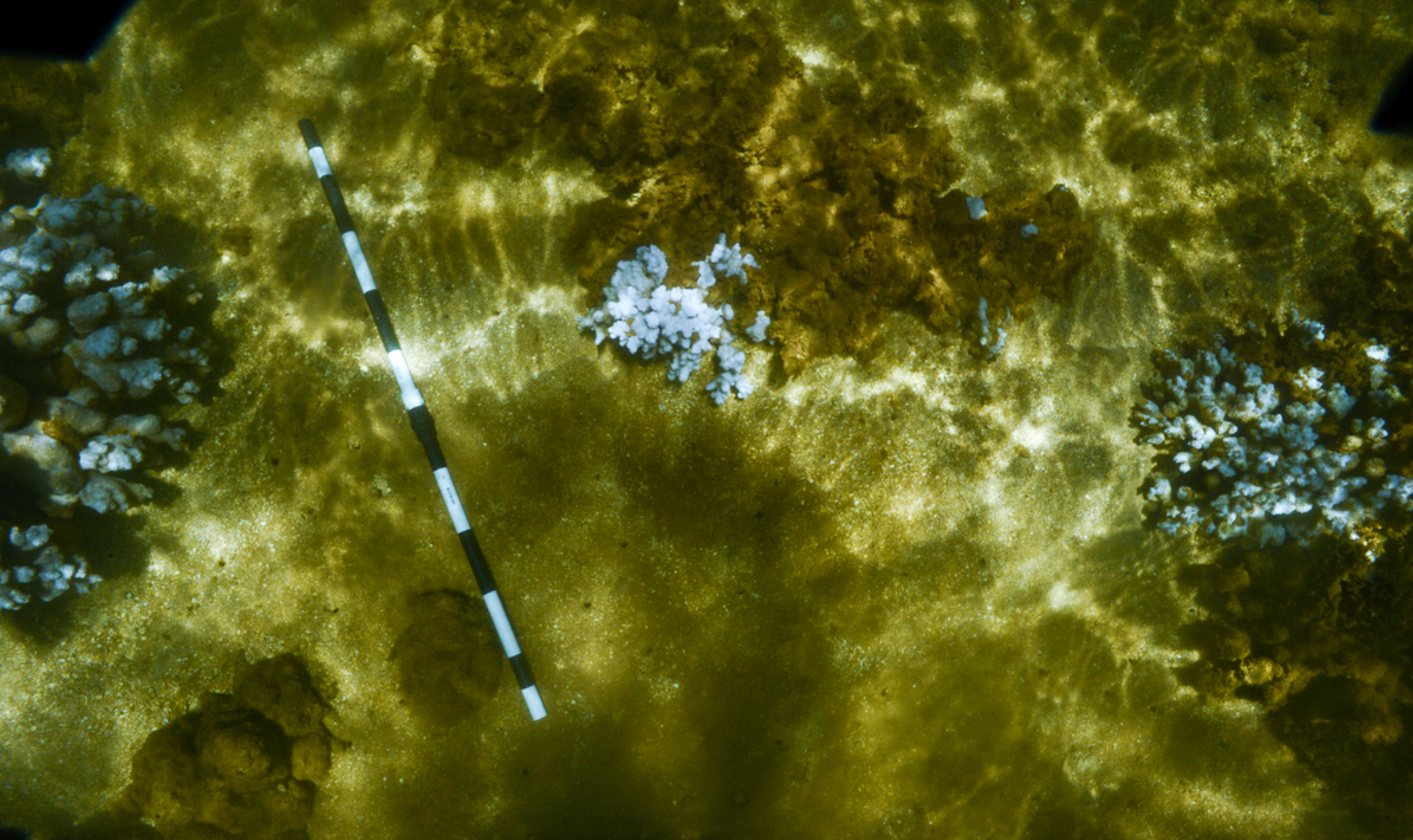
While the drone is completing its flight path, I scan the coral bommies and patch reefs about 20 yards offshore. I develop an underwater survey plan using snorkeling, transect lines, and sophisticated underwater camera equipment. Strapping on all the survey gear, we head out to start recording data. After taking a GPS coordinate and compass heading, I swim a 30 meter transect counting all the reef fish I see, identifying their species name and length. This data shows scientists the density, biomass, and diversity of the fish living on the reef. We want to conduct the fish surveys first, so we do not disturb the fish and have them swim away. Next, I lay out a 10 meter long weighted transect line that has markers on every 10 cm along the line. This survey method is called point intercept, and it is used for identifying the substrate, corals, algae, and invertebrates that fall on a marker along the transect line. Scientists can use these metrics to determine algae and coral cover, as well as the number of mobile invertebrates, like sea cucumbers and starfish.
Conducting these types of in-water surveys are important for verifying the accuracy of the drone survey methods, and for validating the use of this technology for surveying coral communities. Dr. Chirayath has successfully surveyed coral reefs across the Pacific Ocean using his drone-mounted fluid-lensing technology, but this research trip was the first time it was applied to the unique coral reef ecosystems of Hawai’i. He was also testing a new method of conducting reef fish surveys by using the snorkelers in the water as reference point for determining fish length via the fluid lensing drone. The efficacy of this method is still being testing, but it could lead to new process for conducting fish surveys. Typically, scientists would have to conduct hundreds of in-water benthic and fish surveys to get an accurate assessment of coral cover and fish density. But by using drones, scientists can survey a reef much more quickly and safely. When in-water surveys are combined with drone surveys, the resulting data can be much more detailed and accurate than either survey method on its own.
After repeating the survey protocols along the coast, we finally have a comprehensive dataset of the nearshore reefs of Lana’i, from both air and sea. The combination of both airborne and underwater surveys serves as a powerful dataset to best evaluate and monitor coral reef ecosystems.

Images and video courtesy of the Aircraft Center for Earth Studies (ACES) at the University of Miami Rosenstiel School of Marine, Atmospheric, and Earth Science.

